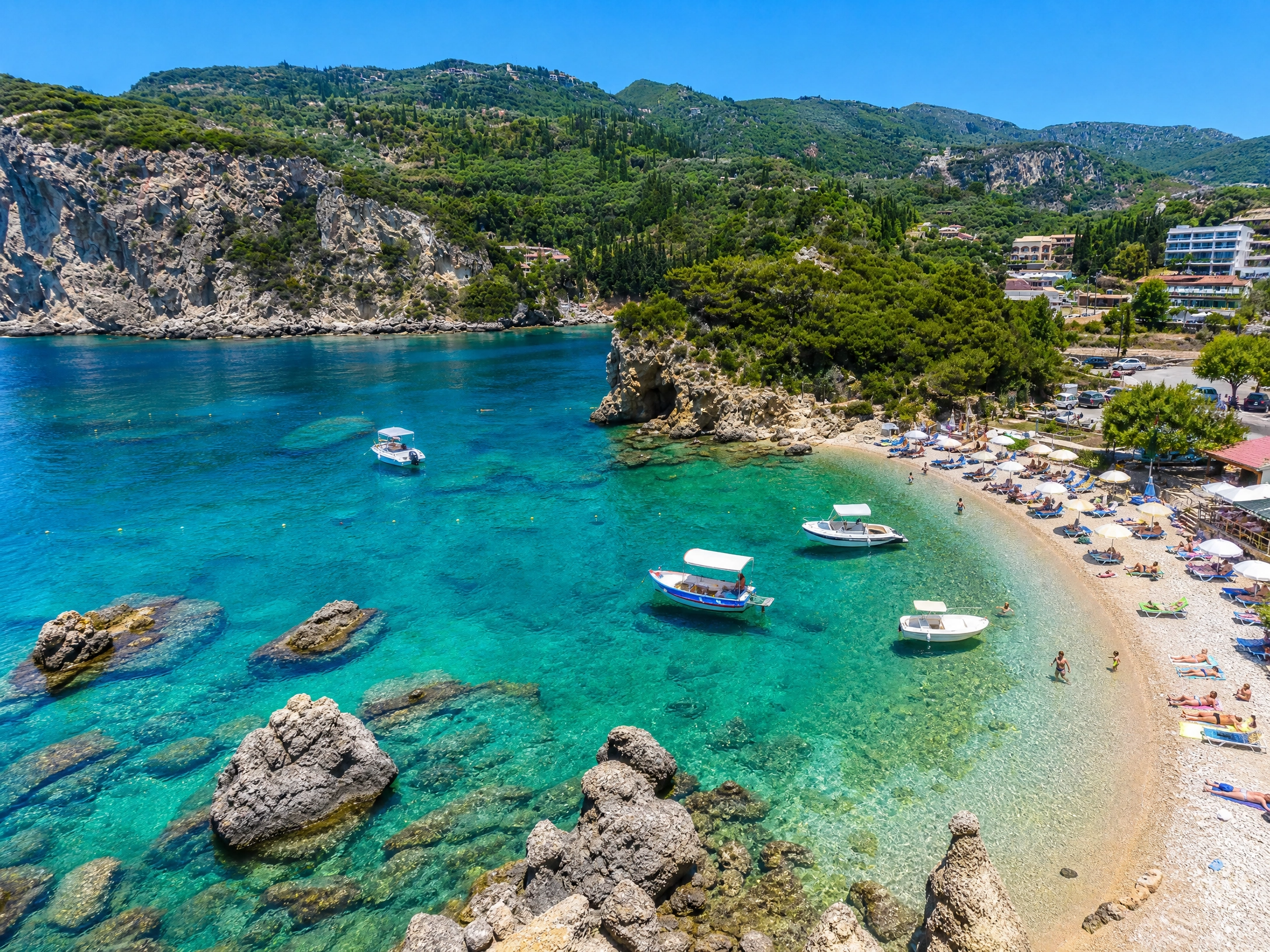
What It Actually Takes to Drive All of Corfu in One Day
Corfu is 60 kilometres long. On a map, that looks straightforward. In practice, driving the island end to end without stopping takes around 90 minutes in light traffic. Add the narrow mountain roads of the north, the unavoidable viewpoint stops, a lunch that runs longer than intended, and any summer traffic around the resort towns between Dassia and Sidari, and a single north-to-south crossing takes closer to three hours of driving. That is before you actually stop anywhere.
This is why the question every visitor with a rental car eventually faces is worth settling before you collect the keys: do you go north first, or south? The two halves of the island are different enough in character that the order matters, and different enough from each other that trying to combine them in a single day means experiencing neither properly.
There is also a specific driving consideration most guides do not mention. The main east coast road runs along the water on your left heading north and on your right heading south. In the afternoon, driving south along the north-east coast puts the sun directly ahead of you on the descent from Kassiopi toward Corfu Town, which is uncomfortable and genuinely affects visibility on a road with no crash barriers in sections. If you are doing the north, driving north in the morning and returning south in the afternoon is the practical direction, not just a scheduling preference.
North Corfu: What to See, Where to Drive, and What No One Tells You
North Corfu Road Trip
Dramatic terrain, mountain roads, Byzantine historyThe north is the island at its most theatrical. The mountains rise sharply from the coastline. The views open over the water toward Albania, visible on clear days just across the channel. The roads wind through a landscape that feels cinematic before you have had time to decide whether that impression is accurate. This is the half that inspired travel writers and attracted European royalty in the 19th century, and the physical reasons for that are still entirely present.
It is also the half that was developed for tourism earliest. The established resort towns of Sidari, Roda, and Acharavi carry a familiar package-holiday weight. Drive through them rather than stopping unless you are specifically there for their beaches, because the north's real character begins the moment you leave the main coastal road.
Kassiopi: Start Here, and Fill Up Before You Leave
Begin on the north-east coast at Kassiopi. The village sits around a small natural harbour where fishing boats have been moored longer than written records confirm. Julius Caesar reportedly stopped here. Cicero mentioned it. Today the harbour is lined with tavernas where the octopus dries in the morning sun, and the quality of the food here is several notches above the resort strip to the west.
Above the village stand the remains of a Byzantine-era kastro, one of the oldest fortresses on the island. The walk from the harbour takes about 10 minutes. The views from the fortress over the narrow channel toward Albania are the first indication of what the north actually offers.
The practical note that no travel guide mentions: Kassiopi is the last reliable place to buy petrol before the mountain roads. If you are planning to drive up Pantokrator and on to Old Perithia, fill the tank here before you leave the coast. There is no petrol station on the summit road and none at Old Perithia. Running low at 800 metres on an exposed mountain is a solvable problem, but a slow and irritating one.
Mount Pantokrator: What the Summit Actually Looks Like
The highest point on the island at 906 metres dominates the north-east. The drive up through Spartilas is part of the experience: the olive groves give way to exposed limestone, the views open over the entire eastern coastline, and the air temperature drops noticeably enough that having a layer in the car is not overcautious.
At the top: a small working monastery (dress modestly if you intend to enter), a telecommunications tower, and on clear days a view that extends north to Albania, west over the full sweep of Corfu, and on exceptional visibility days toward the Italian coast some 130 kilometres away. The summit is also where you understand the island's shape for the first time. From sea level, Corfu is a series of separate impressions. From Pantokrator, it is one comprehensible thing.
Allow a genuine hour at the top. The light changes quickly and the temptation to stay longer is real. Coming down the mountain toward Old Perithia rather than returning the same way adds 25 minutes of driving but is worth it for the change in landscape and to avoid retracing the ascent road.
Old Perithia: The Ghost Village That Has Quietly Come Back
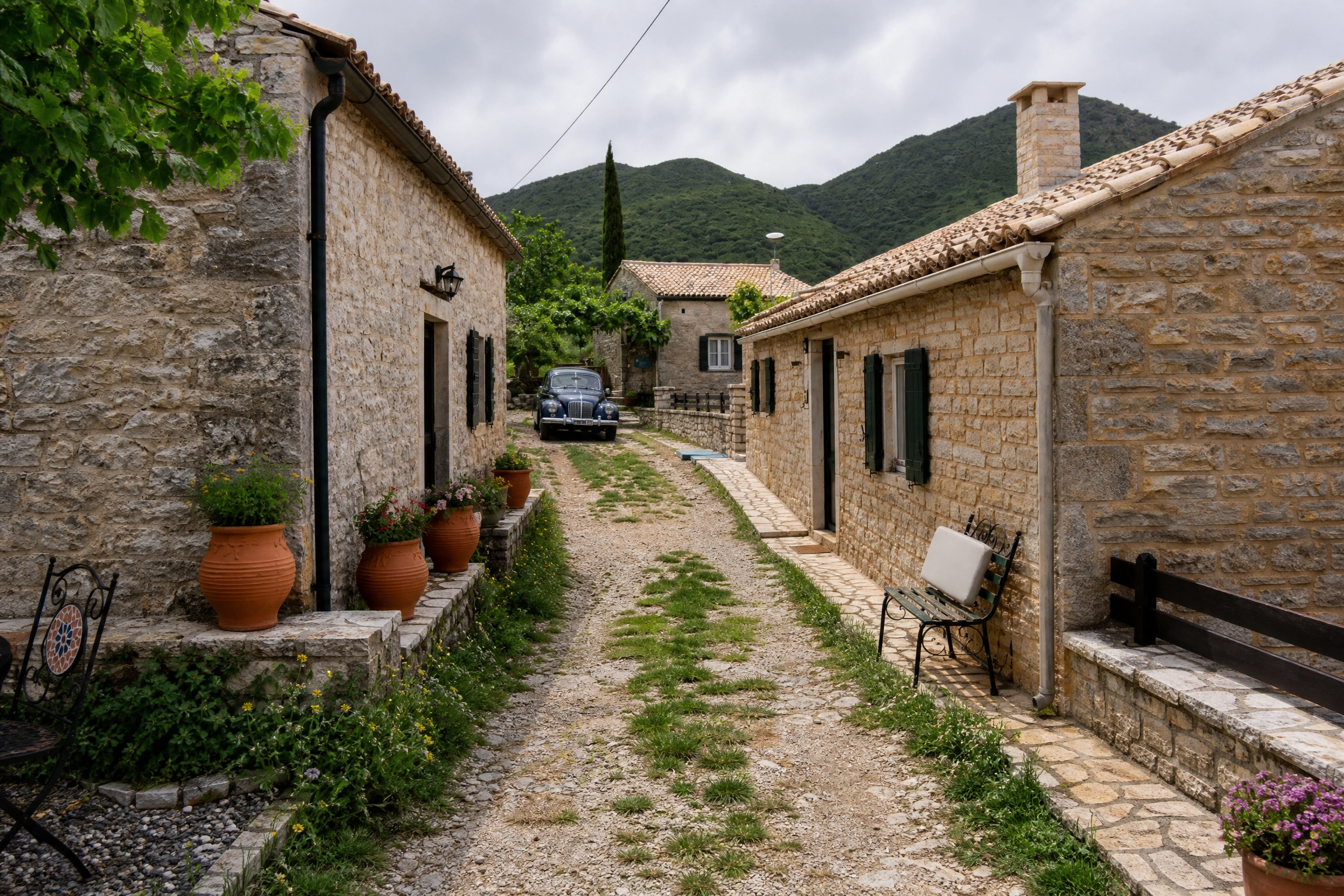
On the northern flank of Pantokrator, reached from the coast via Kassiopi and Loutses, Old Perithia is Corfu's oldest surviving settlement. The village dates to the 14th century, built at altitude specifically to be out of reach of the coastal pirate raids that periodically destroyed everything at sea level. By the 1960s, the last residents had come down to the coast for schools and running water, and the village fell quiet.
It has been returning to life since the 1990s, slowly and without fanfare. A handful of family-run tavernas now operate inside the old stone buildings. The food is slow-cooked, local, and genuinely good. The cobbled square has a quality of silence that is specific to places that have actually been abandoned rather than arranged to look like they have. The surrounding 130 stone houses and eight small churches are a protected heritage site.
One observation that the photographs do not capture: the approach road from Loutses changes character in layers. It starts in scrubby coastal vegetation and moves through oak and chestnut forest that gets denser as you gain altitude. By the time the village appears, you feel sufficiently removed from the coast that the silence makes sense.
Cape Drastis and Peroulades: The North's Best Coastline
Drive west along the north coast past the resort strip and continue to Peroulades, a traditional village on the edge of dramatic cream-coloured sandstone cliffs. Below is Loggas Beach, accessible by steps cut into the cliff. The cliff-top cafe here fills every evening with people who have driven specifically to watch the sun drop into the Ionian. Arrive at least 45 minutes before sunset if you want a table rather than a standing position at the edge.
Cape Drastis, a little further along, is a geological formation rather than a managed attraction: white rock fingers extending into turquoise water, no facilities, no staff, no sunbeds. The wind here is present most days. The final section from the parking area involves a short walk on uneven ground. It is, in the clearest possible sense, a place you have to make a small effort to reach, and that effort does the sorting for you.
Canal d'Amour, Sidari: Go Early or Skip the Main Section
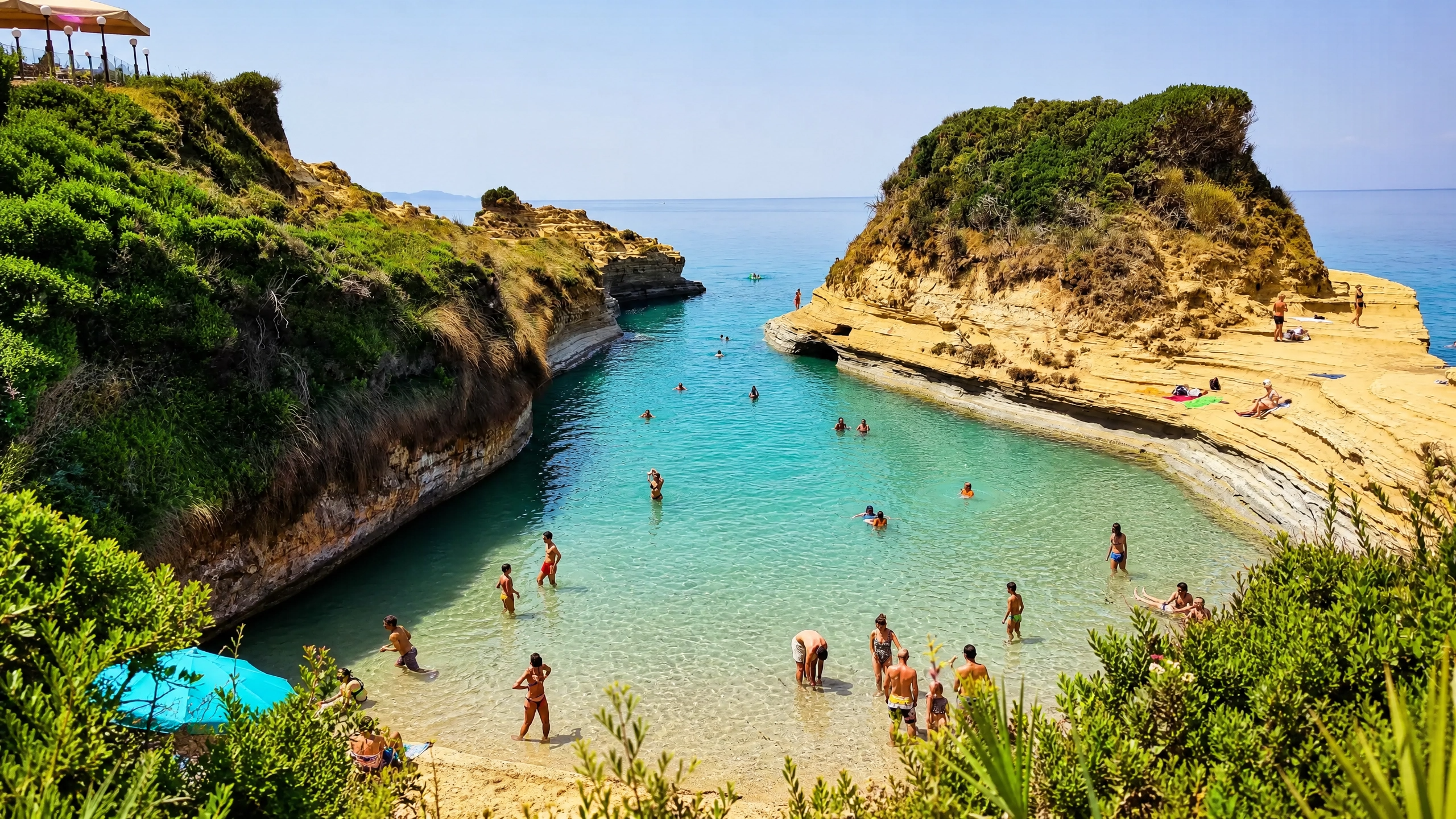
The Canal d'Amour is a series of narrow channels cut into pale golden limestone by centuries of wave action. The rock formations are genuinely unusual: arches, coves, and enclosed pools that trap turquoise water in places that feel nearly private. The legend that couples who swim through the canal will stay together is a marketing embellishment on top of a geological fact that needs no embellishment.
In high season the main accessible section is crowded by 10am. Arriving at 8am gives you a version of the place that is worth seeing. Alternatively, walk east along the coastline from the main beach. Within 10 minutes of walking the crowds thin completely and the rock formations continue for some distance with no one else in them.
What the north is not good for
The north's west-facing beaches, Agios Georgios, Arillas, Agios Stefanos, receive the Maestros wind from the north-west on many summer afternoons. This makes them genuinely windy and choppy in the afternoon when conditions look most appealing on a hot day. If swimming is the priority, the north-east coast around Kassiopi and Avlaki is sheltered and calm. The west-coast beaches of the north are better for kite-surfers and windsurfers than for swimmers seeking flat water.
The north's mountain roads, while manageable in a standard car, are narrow enough that passing requires cooperation. On busy summer days, the road to Pantokrator sees enough traffic that patience becomes part of the drive. This is a reason to start early, not a reason to avoid it.
South Corfu: What to See, Where to Drive, and Why It Feels Different
South Corfu Road Trip
Wide plains, wetland nature, working towns, wild beachesThe south is a different island. The mountains diminish past Corfu Town and the landscape opens: wide olive groves, flatter roads, a coastline that alternates between the sheltered calm of the eastern channel and the completely wind-exposed west. The villages here have a different relationship with tourism, which is to say they largely do not have one. The south rewards patience and deliberate slowness in a way the north does not quite demand.
There is a structural reason the south feels quieter even at peak season, not just a vibe. The main tourist infrastructure, the charter flights, the package resorts, the excursion boats, is concentrated in the north and along the north-east coast. The south has a handful of small beach resorts at Messonghi, Moraitika, and Kavos, but Kavos specifically draws a particular kind of young nightlife crowd that has nothing to do with the rest of the south's character. The majority of the southwest and southeast coastline is simply not built for mass tourism and has not been in the 40 years since the rest of the island was.
The Achilleion Palace: More Interesting Than Its Reputation Suggests
Ten kilometres south of Corfu Town, in Gastouri, the Achilleion Palace was built in 1892 by Empress Elisabeth of Austria (Empress Sisi) as a private retreat from the Habsburg court. She chose Corfu after a difficult period and the palace was designed by Italian architects in a Pompeian style, surrounded by terraced gardens with sculptures from Greek mythology. A 15-metre bronze statue of the dying Achilles dominates one terrace. After Elisabeth's assassination in 1898, Kaiser Wilhelm II purchased the palace and used it until the First World War.
What most visitors miss by treating it as a quick stop: the gardens change character on each terrace level. The lower terraces are formal and manicured. The upper terraces are wilder, the views wider, and the statuary becomes stranger. The casino scenes in the 1981 James Bond film For Your Eyes Only were filmed here, a detail that does not improve the historical significance of the place but does mean the interior looks vaguely familiar even if you cannot immediately identify why.
Chlomos: The Village That Shows You Both Corfu Coastlines at Once
Inland from the east coast, at between 270 and 320 metres on the slopes of Mount Morovigli, Chlomos is positioned on a ridge rather than a slope. On a clear day, both coastlines are simultaneously visible from the village: the calm eastern channel and the open Ionian to the west. Paxos and Antipaxos sit on the southern horizon. This is a consequence of topography, not a travel writer's exaggeration.
The village dates to the 13th century. A mansion here once belonged to the line of Thomas Palaiologos, brother of Constantine XI, the last Byzantine emperor. The Venetian architectural influence is still present in the stone houses: external staircases, arched ground floors, window proportions that belong to a specific period and place. The main square has kafeneia and a taverna. The food is local and not oriented toward visitors, which is the correct expectation to arrive with.
The approach road is steep and narrow. A standard rental handles it without difficulty, but slowly and with care. The Corfu activities guide covers more of the south's inland villages if you want to build a longer loop from Chlomos.
Korission Lagoon and Halikounas Beach: The South's Wildest Landscape
The southwestern corner of Corfu contains a landscape that surprises most visitors who find it. Lake Korission is a protected wetland lagoon separated from the Ionian Sea by a narrow sand barrier, Halikounas Beach, which runs for roughly three kilometres. The lagoon hosts over 120 recorded bird species. Flamingos appear in autumn and winter, alongside significant populations of wading birds on the eastern flyway migration.
Halikounas Beach is everything the northern resort beaches are not. No sunbeds cover most of its length. No bars compete for your attention along the majority of the strand. The sand is coarse and golden, the water clear, the west wind consistent and strong. Kite-surfers and windsurfers have been using this beach for decades because the Meltemi conditions are reliable and the space to operate is genuinely unlimited.
Walk south from the car park rather than setting up immediately at the nearest point. Within 15 minutes of walking the beach is effectively empty. The lagoon side is worth looking at as you walk: the colour contrast between the brackish lagoon water and the open sea beyond the sand barrier is distinct and changes hour by hour.
Issos Beach: Sand Dunes in Greece, Which Is Not Something You Expect
Immediately north of the point where the Korission lagoon narrows, Issos Beach has genuine wind-formed sand dunes backed by a cedar grove. This is not a landscape Greece is normally associated with. The dunes were formed by consistent westerly winds over a long period and are stable enough to walk on without destroying them. The north end of the beach, where the dunes are most pronounced, is quiet even in peak summer because most visitors stop at the main car park and do not walk further.
Lefkimmi: The Town That Tourism Has Not Organised
Near the southern end of the island, Lefkimmi is Corfu's second-largest settlement and one of the least visited by tourists. The river Lefkimmi runs through the town centre, past riverside kafeneia and small traditional boats moored at simple jetties. Rick Stein filmed at a riverside taverna here and the restaurant still carries the association. That visit was not a discovery of somewhere secret; it was a confirmation of what had been true for a long time, which is that Lefkimmi's riverside eating is quietly excellent.
Walking along the river in the early evening is one of the more genuinely ordinary experiences the island offers, in the best possible sense. The town's economy is agriculture and fishing. The kafeneia are full of local people going about their evening in a way that has no awareness of, or interest in, being observed by visitors.
Boukari: Where to Have Lunch on the South-East Coast
On the south-east coast, the fishing hamlet of Boukari is a handful of fish tavernas, a small jetty, moored boats, and calm clear water. There is no beach in the conventional sense. The entry to the sea is from stone slabs with a ladder. The water in the sheltered bay is flat and very clear, the opposite of Halikounas in every physical respect.
Come here for lunch. Order the fish. The choice is what came in that morning, not a menu designed around tourist expectations. Plan to stay longer than you intended, because the combination of fresh fish, sheltered water, and genuinely unhurried service makes leaving a decision you keep postponing.
What the south is not good for
The south's eastern coastline from Messonghi to Boukari is calm and pleasant but the beaches are narrow and in some sections rocky. If long sandy beach days are the primary objective, the west coast at Halikounas and Issos delivers the sand but not the calm water. The south does not have a beach that combines wide sand with sheltered swimming the way Glyfada or some of the north-east coves do.
Kavos, at the island's southern tip, is a nightlife resort with a specific character entirely separate from the rest of the south. It belongs to a different kind of trip. If that is not what you are there for, plan your south day to avoid it or treat it as a drive-through.
North vs South Corfu: A Factual Comparison by Category
Both halves are worth your time. These comparisons are honest rather than designed to push you in either direction.
| Category | North Corfu | South Corfu |
|---|---|---|
| Terrain | Dramatic mountains, steep coastal cliffs, narrow gorges | Rolling hills, wide plains, flat wetland coast in the southwest |
| Roads | Narrow and winding above the coast, steep on mountain approaches | Easier on main routes, steep only on the approach to Chlomos |
| Beaches | Coves and pebble, some dramatic but requiring a walk; west coast exposed to afternoon wind | Long sandy stretches at Halikounas and Issos, largely undeveloped; east coast narrow |
| Swimming conditions | Best on the north-east coast (Kassiopi, Avlaki); west coast choppy in afternoon | East coast calm; west coast at Halikounas and Issos has consistent wind and some chop |
| Tourism density | Moderate to high along the coastal resort strip; lower off-road | Low across most of the southwest and southeast; quiet even in August |
| Historical interest | Byzantine fortress at Kassiopi, 14th-century Old Perithia, ancient harbour history | 13th-century Chlomos, Byzantine and Venetian architectural detail, Achilleion Palace |
| Food highlight | Harbour tavernas at Kassiopi, stone tavernas at Old Perithia | Riverside fish at Lefkimmi, fresh catch at Boukari, local market town food at Agios Mattheos |
| Nature | Pantokrator mountain ecology, forest on the northern flank | Korission Lagoon with 120+ bird species, sand dunes at Issos, cedar grove |
| Petrol stations | Last reliable station is in Kassiopi before the mountain roads | Available in Messonghi and Lefkimmi |
| Best starting time | Early morning: drive north in the morning, return south in the afternoon to avoid sun glare on the east coast road | Morning or early afternoon: the south's roads are less affected by sun angle and traffic timing |
Which Half to Do First, Based on Your Trip Length
The honest answer is that the order matters less than the decision to keep them separate. The mistake is not choosing wrong; it is trying to combine them on the same day and experiencing a version of each half that was too rushed to be representative of either.
If you have three or four days: pick one half and do it properly. The Corfu in April guide and the Corfu in May guide cover the shoulder season timing for both halves, which is worth reading if you are planning outside peak summer.
If you have a week or more: three days in the north, two in the south, with a day at either end for Corfu Town and Paleokastritsa. Paleokastritsa sits on the west coast between the two halves and belongs to neither, but bridges them naturally as an afternoon stop between days.
If you have strong preferences: travellers who love dramatic views, history, and variety tend to develop a loyalty to the north. Travellers who want space, quiet, and the feeling that they found something rather than being directed to it tend to become south people. Both groups, without exception in my experience, have driven the whole island and made a conscious choice. The only way to know which side is yours is to drive both.
The one thing both halves share
Neither half is fully accessible by public transport. The KTEL bus network covers the main coastal road and Corfu Town. The stops that make both the north and south worth visiting, Pantokrator, Old Perithia, Cape Drastis, Chlomos, Korission Lagoon, Lefkimmi, Boukari, require a car. Arriving at the airport and collecting a rental on the spot is by far the most practical arrangement. Browse the UNO fleet before you arrive so the collection is as fast as possible.
Bases, Cars, and Logistics for Both Halves
Where to base for the north
Dassia or Gouvia give you central access to both the north-east coast and the north-west without committing to either extreme. Kassiopi is the best base if you want the north-east, Pantokrator, and Old Perithia in detail. Corfu Town remains the most flexible base if you are not committing to one half exclusively.
Where to base for the south
Messonghi or Moraitika puts you 30 minutes from Lefkimmi and Boukari in one direction and 20 minutes from the Korission Lagoon in the other. Corfu Town remains the most flexible base if you are not committing to one half exclusively.
Which car for which half
The north demands confidence on winding mountain roads. A small hatchback handles everything, but you should be comfortable reversing on narrow roads. The Pantokrator summit road has sections where two cars cannot pass simultaneously. The south is easier driving overall. Neither half needs a 4x4. Browse the UNO fleet and choose based on your comfort level.
Petrol planning for the north
Fill up at Kassiopi before heading into the Pantokrator road network. There is no petrol station on the summit road, none at Old Perithia, and none on the road back toward Loutses. This is not a crisis if you start with a full tank; it is only a problem if you do not.
Drive direction on the north-east coast
Drive north in the morning and return south in the afternoon. Heading south along the north-east coast in the afternoon puts the sun directly ahead of you on descents with no crash barriers in sections. This is a specific, practical reason to plan the direction of the north loop, not a general observation about timing.
Renting with UNO
Airport pickup, rentals from 18 years old, no credit card required, free additional drivers. Sharing the driving is genuinely advisable on a full north day with the mountain roads involved. Contact the team with any questions before collecting the car.
Frequently Asked Questions About the North vs South Corfu Drive
Should I visit north or south Corfu first?
How long does it take to drive from one end of Corfu to the other?
Is the north or south of Corfu better for beaches?
Can you do both north and south Corfu in one day?
Are there petrol stations in the north of Corfu?
What is the best base for exploring north Corfu?
One Car, Two Very Different Days
Pick up at Corfu Airport. No credit card required. Rentals from 18 years old. Free additional drivers. 24/7 support on the road.
Browse Our FleetQuestions about routes or vehicles? Contact the UNO team.

Previous article
Nightlife in Corfu: Complete Guide for Travellers 2026
Next article
Corfu's 10 Villages You'd Never Find Without a Car

Partager :


Related Articles


Planning this route?
We can help you choose the right car for Corfu
If your itinerary includes villages, beaches or mountain roads, browse the fleet or ask us directly which category fits best.